Other maps of the US
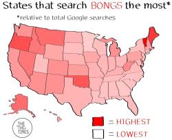
US states that search Google for bongs the most, relative to total
searches
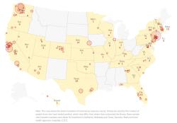
Coronavirus in the United States
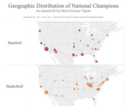
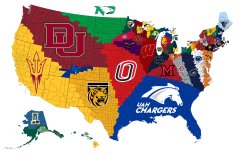
Geographic Distribution of National Champions for NCAA Men's Sports
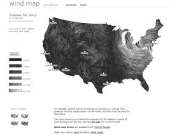
Wind flow map of the US. Interactive map >>
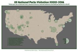
US National Parks Visitation, 2000-2016.
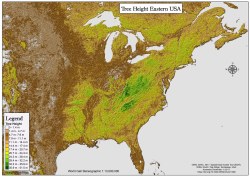
Tree Height in the USA
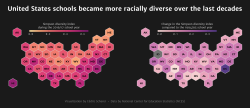
Status and Trends in the Education of Racial and Ethnic Groups in
the US
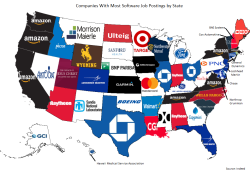
Companies With the Most Software Job Postings in Each U.S State
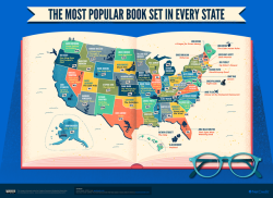
This map shows the most popular book set in every state. (Source:...
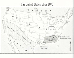
Fantastic Speculative future America maps from the novel American
War by Omar El Akkad. The book contains many climate based...
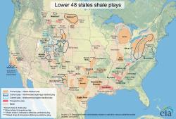
Major US Shale Plays - Locations Likely to Have Fracking
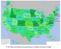
If all US states and cities used names of Native American Origin.
The Closest NCAA Hockey Team to Each US County
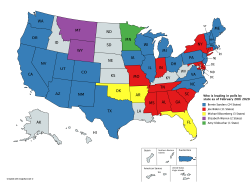
Witch democratic candidate is leading in polls by state as of
February 20th 2020
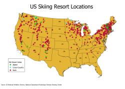
Ski resorts in the US.
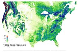
Total Tree Presence in America
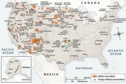
Indian reservations in America
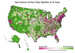
Comparing Native American and Asian Indian origin populations by US
county.
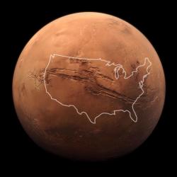
United States compared to Mars
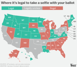
State map of where it's illegal to share a photo of your ballot

The Oldest Colleges in America by State
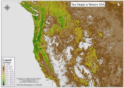
Tree Height in the Western USA
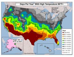
Days per year with high temperatures above 90°F in USA.
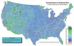
Average distance to the nearest road in the US.
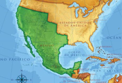
United States and Mexico on the eve of the Mexican-American War,
1846
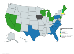
Leading candidates based on updated polls for the Democratic parties
according to Fivethirtyeight, as of February 12th 2020
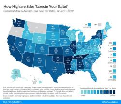
2020 sales tax percentages
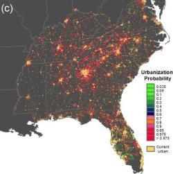
Projected Development in the Southeast, 2060
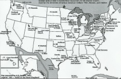
A map of all the Internment camps for Germans and German-Americans
during WW2.
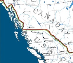
The Canadian-American border, if 54'40" had succeeded.
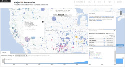
Interactive map visualizes major dams and reservoirs in the United
States. Data from the Global Reservoir and Dam Database...
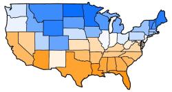
Average temperature ranking of USA
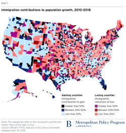
Immigration contributions to population growth 2010-2018.
Nuclear Targets in 2,000 and 500 Nuke Scenarios Against The US
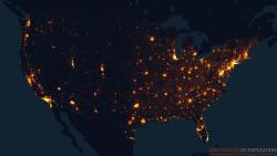
Contiguous US Population
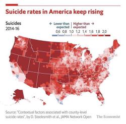
American suicide rates, 2014-2016.
Coldest day of winter across the USA.
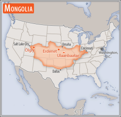
Size comparison of Mongolia with the United States
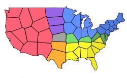
Map of America, but the geographic center of each state is the new
border.
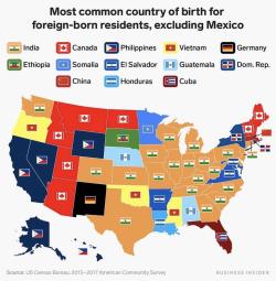
Most common country of birth for foreign-born residents in the
United States, excluding Mexico.
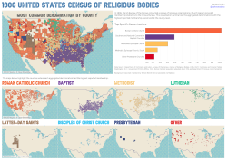
Maps of the most common religious denominations in the US in 1906.
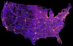
United States' 8 million miles of roads, streets and highways.
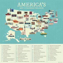
A map of the most endangered building in every U.S. state.
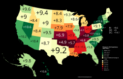
Change in Life Expectancy between 1959 and 2017.

U.S. population change by county. Red means people leaving. Blue
means people arriving.
The highest temperature by state.
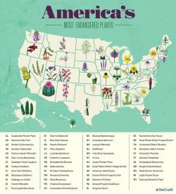
The most endangered plant in every U.S. state.
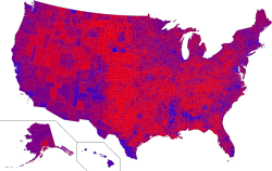
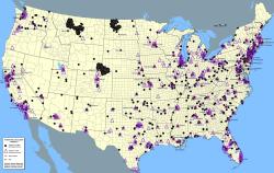
"Purple America" map of the 2016 Presidential Election: Rather than
giving each county purely Red or Blue based on party...
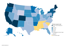
Minimum wage by US state
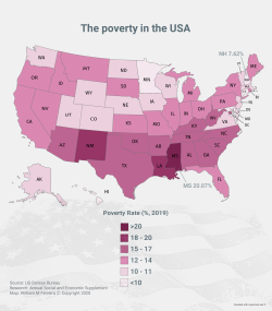
The poverty in the US, 2019.
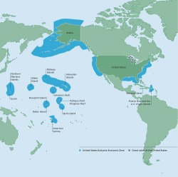
The United States is an Ocean Nation - Exclusive Economic Zone of
the U.S.
Candidates who are leading in polls for the Democratic Primary by
state. DISCLAIMER: Polling data for the following states may...
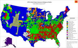
The 1890 United States Census of Religious Bodies
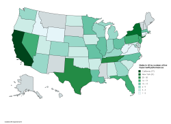
States by number of live Taylor Swift performances
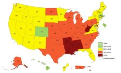
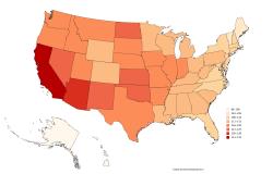
Adult Obesity Prevalence Map

In February 20,000 US troops will deploy to Europe in the largest
deployment to Europe since the end of the Cold War
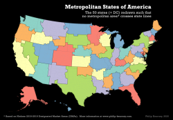
Metropolitan States of America: The 50 states redrawn such that no
metropolitan area crosses state lines.
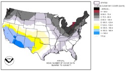
Annual number of clear days in contiguous United States
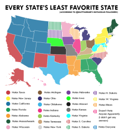
Every US state's least favorite state.
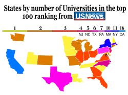
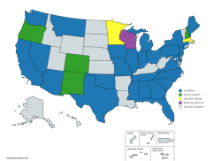
States by number of colleges in the 2020 top 100 ranking