United States Map with Cities and Physical Features


Physical features and shaded relief
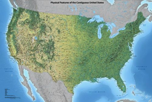
This map highlights various physical features found in the 48 contiguous US states, including mountains, plains, rivers, and lakes. The colors on the map represent the diverse natural environments across the continent, ranging from the forested regions in the east to the snowcapped Rockies in the west and the desert southwest. Additionally, the map includes a selection of cities and faint state lines to provide reference points.
The map is in the public domain and available free of charge here.